
Beloit ZIP Delivery Areas
USPS publications associate two delivery ZIPs with Beloit: 53511 and 53512. They are postal service areas, not a legal outline of the incorporated city. The ZIP code directory therefore uses restrained labels. Research supports 53511 as the primary delivery area and nearby addresses using “Beloit” as the postal city. It supports 53512 as secondary or commonly PO-box addressing, but the exact current delivery type for any address must be checked in the USPS tool.
| ZIP Code | Areas Covered | Post Office | Notes |
|---|---|---|---|
| 53511 | Primary Beloit delivery area and nearby Beloit postal addresses | Beloit Post Office, 300 Mill Street | Can extend beyond the city boundary |
| 53512 | Secondary Beloit postal or PO-box addressing | Beloit Post Office service area | Check a full address or box in USPS Lookup |
No official county ZIP map with verified neighborhood names was found in the research. For that reason, the table does not assign Merrill, Hackett, downtown, or other local areas to one code without a full-address check. Beloit had 36,657 residents in the 2020 Census and an estimate of 36,649 in July 2025, but those city totals cannot be divided between the two postal codes from the available official evidence.
Check Beloit ZIPs With USPS
The USPS ZIP Code Lookup supports city-and-state and full-address routes. A city search answers which postal codes USPS associates with Beloit. A street search is stronger because it tests a complete delivery point and normalizes the postal form. The USPS screenshot attempt failed in the manifest, so no image is used and no live result type is claimed beyond the researched delivery codes.
| Lookup field | Question answered | Local caution |
|---|---|---|
| City and state | Postal ZIPs associated with Beloit | Does not establish city limits |
| Full street address | Deliverable code for one address | Needs the complete current address |
| ZIP alone | Postal place information | Does not identify residents or parcels |
For an old address that does not match, keep its original form. Try the street without a directional and compare the number with city grid rules, historic directories, plats, and the current municipality. Modern postal formatting should not be applied backward as if it existed in an early directory.
Three Beloit Address Keys
A parcel search uses three kinds of location. The situs address is where the parcel lies. The tax mailing address is where notices are sent, which may be a different city, an agent, or a PO box. The legal description identifies title geography through a lot, block, subdivision, certified survey map, or other land reference. A ZIP code may appear in either street or mailing data, but it cannot replace the legal description.
The Rock County deed index proves the difference. It does not search by street, parcel number, or ZIP. A researcher must first use the tax system or GIS to connect a known address to the owner and legal description, then search the Register of Deeds by party, document number, book and page, or tract. That handoff belongs after the postal check, not before it.
Find Beloit Residents by ZIP
Official sources do not provide one browseable resident list for either Beloit delivery area. Use a ZIP code directory to narrow the geography, then move to a purpose-built record. The Rock County tax portal is confirmed to accept an address, parcel number, or Tax ID, but the research did not confirm a ZIP-wide filter. MyVote accepts a ZIP within address mode and returns polling information for that address, not a street roster. DSPS offers a confirmed ZIP filter for certain credential searches.
- Enter the full address in USPS Lookup and save the normalized form and delivery ZIP.
- Search the Rock County Tax Database by address, parcel, or Tax ID. Confirm the Beloit City Assessor route for city parcels.
- Select the parcel in Rock County GIS and check whether it lies in the city, the Town of Beloit, or another municipality.
- Use MyVote address mode for personal polling details or DSPS advanced search for a public credential within the ZIP.
Once the code narrows to an address, the Beloit street directory explains the parcel-by-parcel record chain. Keep the postal result and government jurisdiction separate in the notes. They may both say Beloit while pointing to different custodians.
Beloit ZIPs Meet the River Grid
Beloit's address pattern is unusually useful when a historic number needs testing. City ordinance §11.17 uses the Rock River as the east and west dividing line and assigns number units in 20-foot steps. East-west streets place even numbers on the south side and odd numbers on the north. North-south streets place even numbers west and odd numbers east. The Building Inspector assigns city addresses and holds the official reference map.
The Town of Beloit uses a related but distinct grid. Its base lines include the state line and the Rock River, with roughly 1,000 numbers per mile. This is one reason a Beloit postal address does not prove City of Beloit jurisdiction. Annexations also changed the municipal edge, and Town Map 12 records annexations by nearby municipalities from 1980 through 2011. The ZIP code directory must follow the parcel's current boundary, not guess from the street number alone.
Verify Beloit ZIP Geography
Use the Rock County Tax Database Search for parcel, current-tax, and historical-tax information. Beloit tax pages describe address, parcel number, and Tax ID as supported routes. The exact live result fields and any ZIP-wide browse option were not captured, so do not assume that owner name, exemption, value, or ZIP filters appear until they are visible in the current portal.
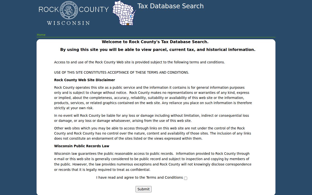
The manifest captured the public Rock County tax-search landing screen used after a postal check.
Rock County's GIS is the map check. Search or pan to Beloit, select the parcel polygon, copy the parcel or Tax ID, and inspect the municipal relationship. The map may show roads, parcels, and other available layers, but its own survey warning matters. GIS is a discovery tool, not a survey or title instrument. The assessor, deed, plat, and survey remain the controlling sources for ownership and legal boundaries.
Beloit ZIP Fields Have Limits
MyVote's address mode requires street address, unit when applicable, city, and ZIP. It can identify the voting municipality, ward, polling place, ballot, and election information connected to that address. It does not disclose a public list of everyone in 53511 or 53512. A person's own name lookup separately requires first name, last name, and birth date.
DSPS advanced trade search has a real five-digit or partial ZIP field alongside credential type, required status, and last or business name. It can return public license information such as name, credential number, profession, location, dates, status, and a discipline indicator. That is a credential directory within a postal area, not full resident coverage. DFI corporate records may add registered offices and agents, but those office addresses likewise do not prove a home location.
Historic Beloit ZIP Clues
Older city and telephone directories should be read in the address system of their own date. Beloit volumes cover selected years from the nineteenth century into the 1930s, while Library of Congress holdings list Janesville-Beloit criss-cross directories for 1980 through 1995. A criss-cross volume is arranged by address, making it useful after a modern ZIP search has narrowed to a street. It records a reported occupant or telephone subscriber, not every person at the address.
Historic addresses can shift because of renamed roads, changed numbers, annexations, and movement across the Wisconsin state line. Pair the directory line with the 1890 Sanborn sheets, a plat, a deed, the river-based number grid, and the period's municipal boundary. Preserve both the old printed address and today's USPS form. A current ZIP code should never be used as proof that an early address lay in the incorporated city.
Beloit ZIP and City Limits
The key limit is simple: USPS designs ZIP codes for delivery, while cities and towns set legal jurisdiction. Addresses using Beloit as the postal city may sit in the Town of Beloit or another Rock County pocket. A parcel within the city may also use postal routing that does not mirror the city line. This mismatch decides which assessor, permit office, clerk, and local records custodian can answer a request.
- ZIP vs ZIP+4
- A five-digit area covers a broader postal zone. The extra four digits narrow delivery to a smaller segment.
- PO-box ZIP
- A code or use tied mainly to post-office boxes rather than ordinary street delivery.
- Unique ZIP
- A code assigned to one large organization. No unique Beloit ZIP was verified in the research.
- Carrier route
- A postal delivery path within a ZIP, not a city ward, parcel boundary, or resident roll.
Boundary check. Confirm the full address with USPS, then use Rock County GIS and the proper assessor before choosing a Beloit records office.
That sequence prevents a common error. The words “Beloit, WI” on an envelope identify a postal place, not the government that holds every record. Note the delivery code, parcel municipality, situs address, tax mailing address, and legal description as separate fields. The result is a useful ZIP code directory entry without overstating who lives there or where the city line runs.