
Beloit Block Lookup Sources
Block research is a set of small, separate checks. The GIS map defines which parcels are actually adjacent. A tax entry may name an owner. A deed may confirm the recorded interest. A city association can connect people who choose to take part. None is a list of every person present.
| Source | What it shows about a block | Access |
|---|---|---|
| Rock County GIS | Parcel shapes, roads, and adjacent land | Public interactive map |
| Rock County tax database | Parcel, current-tax, and historical information | Public portal or office |
| Register of Deeds | Recorded parties and legal descriptions | Tapestry, Laredo, counter, books |
| MyVote Wisconsin | One user’s own registration and polling data | Individual name or address form |
| Neighborhood initiative | Voluntary civic organizing, not member rosters | City information and guide |
Start with geography. Two homes that seem close from the road may sit on lots that do not touch, while an alley or narrow parcel can change the true block set. Owners and occupants must remain separate in the notes.
Map Beloit Records Parcel by Parcel
The Rock County Interactive GIS map is the geographic starting point. Search or pan to the subject address, select its polygon, and capture the parcel identifier and legal description. Then click the polygons that share an edge or sit directly across the street. Exact button names and optional layers were not verified in the unattended viewer, so rely only on controls visible in the live session.
- Locate the subject parcel and confirm that it lies in the City of Beloit.
- Select each nearby parcel separately instead of assuming one owner controls several lots.
- Open the matching tax record by address, parcel number, or Tax ID.
- Record owner and mailing details as owner evidence, not proof of residence.
- Use legal descriptions and party names in the deed index only when title history matters.
The map is not a survey, and GIS does not establish title. For a whole named road rather than the immediate radius, use the Beloit street directory workflow.
Beloit Owners Are Not Occupants
The tax mailing address is where notices go. It can belong to an owner at another address, a trust, company, attorney, agent, or post office box. Even a matching situs and mailing address does not identify every resident. Tax flags, if visible, are assessment clues rather than a live head count.
Deeds have the same boundary. A warranty deed, quitclaim deed, mortgage, satisfaction, lien, easement, plat, or survey serves a land purpose. It may name spouses or trustees, but it is not intended to catalog the household. The Register of Deeds index also has no address or parcel search. Use GIS and tax data to translate the address first.
- Adjacent parcel
- A separate tract that touches or closely borders the subject lot.
- Legal owner
- The person or entity shown by the relevant ownership record.
- Situs
- The physical location of a parcel.
- Mailing address
- The destination for tax notices, which may be elsewhere.
Beloit Builds Neighborhood Associations
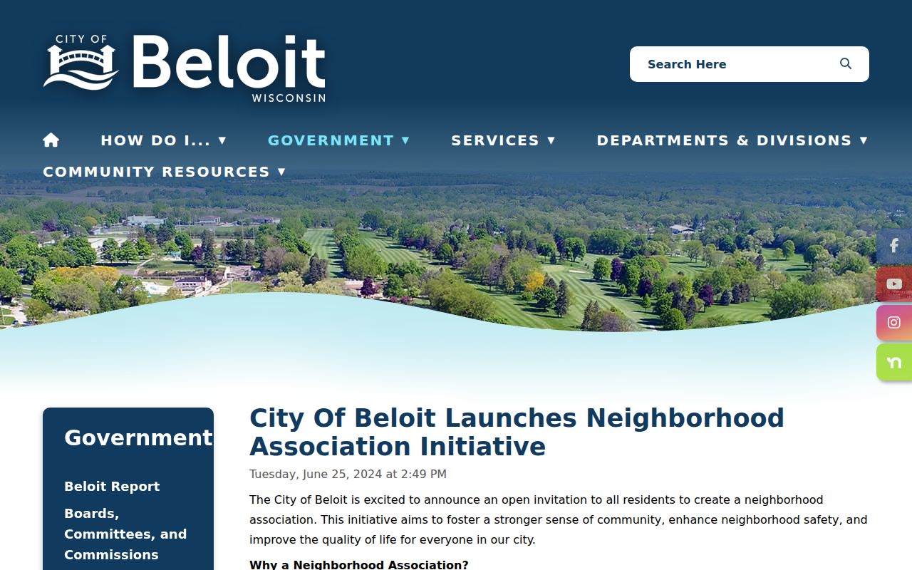
In June 2024, the City of Beloit invited residents to create neighborhood associations and offered City Manager support with outreach and resources. The initiative is intentionally open-ended. It does not establish a finished directory of associations, officers, members, or households.
The city’s neighborhood-association announcement is the official starting point. Its formation guide describes ways a group can organize. Contact the city rather than guessing that a block has an association or publishing names from an old flyer.
The official initiative page is also captured in the project image set.
Merrill and Hackett Beloit Context
Merrill and Hackett appear as named contemporary neighborhood listening areas in Beloit planning context. Their names can help frame a civic question, but they are not evidence that a specific person belongs to an organization. Neighborhood labels, postal labels, voting districts, and parcel boundaries serve different purposes.
Beloit also meets South Beloit, Illinois, at the state line and connects closely with the Town of Beloit. A postal address may use Beloit while the parcel lies outside city government. The river shapes the city numbering grid, while the Town of Beloit uses a different base line. Confirm the jurisdiction in GIS before contacting a city department or interpreting a community notice.
Geography check. A Beloit ZIP or mailing label does not by itself prove City of Beloit jurisdiction.
MyVote Is Not a Block Lookup
MyVote Wisconsin lets a person retrieve their own registration data. Name search requires first name, last name, and birth date. Address search requires street address, unit when relevant, city, and ZIP. Results support registration, polling, ballot, and personal voting-history tasks.
That design does not create a public browse-by-block roll of Beloit neighbors. The City Clerk handles municipal election access and the Rock County Clerk handles county administration. Confidential elector rules and Wisconsin Safe at Home can suppress an actual address. Never treat a missing voter result as evidence that a home is vacant.
Note: Personal registration tools should be used as designed, not reverse-engineered into a block directory.
Beloit Community Directories Differ
Several Beloit organizations provide useful context without becoming household lists. Downtown Beloit Association materials concern businesses, events, and district contacts. The Greater Beloit Chamber’s 2026 guide offers voluntary organization entries with representative names, addresses, phones, websites, and descriptions. Beloit Historical Society, Beloit College Archives, and library collections document past communities.
| Community source | What it can establish | What it cannot establish |
|---|---|---|
| City association initiative | How residents may form a group | A complete current roster |
| Downtown association | Business and district contacts | People living above or near a business |
| Chamber guide | Voluntary organization contacts | Private household membership |
| Historical collections | Dated photos, names, buildings, and stories | Current presence at an address |
The strongest use is corroboration. A parcel record supplies geography, an official business filing can verify an entity, and a dated local item adds context. Do not turn voluntary civic participation into an inferred private relationship.
Official and Commercial Block Results
Official rolls are narrow and dated. They identify a parcel, recorded party, case, license, or self-service voter record within stated rules. Commercial neighbor tools often combine prior addresses, phone data, inferred relatives, and cached material. Their broad result may look convenient but can merge people with similar names or retain stale addresses.
| Question | Official record | Commercial category |
|---|---|---|
| Who owns this lot? | Tax record plus deed | May repeat an old owner |
| Which lots touch? | GIS parcel map | Boundary source may be unclear |
| Who lives here now? | No complete public household roll | Often inferred and dated |
| Can the result be corrected? | Contact the named custodian | Provider-specific process |
Prefer the record whose office, purpose, date, and access rule are known. A broad list should never outweigh a current parcel or deed record, and even those establish ownership rather than the full household.
Registry Geography Is Not a Roster
The Wisconsin Sex Offender Registry has name and geographic searches, including ZIP and one-, two-, or three-mile radius modes. Its geography is designed for the registry’s public-safety purpose. It does not identify all residents inside a circle, and it must not be blended into a general list of Beloit neighbors.
The registry publishes a misuse warning. Check its current record and terms directly, since addresses and supervision status can change. Never use registry information to threaten, harass, intimidate, or take unlawful action.
Confirm a Beloit Block Finding
Check every nearby parcel as a separate record. Record the parcel identifier, legal description, tax mailing address, source date, and the boundary shown in GIS. If a name appears only in an old directory or community publication, label that date instead of presenting the person as a current neighbor. When records conflict, the office that keeps each record is the best correction channel.
Wisconsin Public Records Law offers access to existing city and county files that are not posted online. A useful request names the department, record type, address, and date range. It does not ask staff to create a new household list or reveal a protected location. City records, county land data, archive material, phone calls, mail, and in-person counters all remain valid access paths when a web form stops short.
Privacy Limits on Beloit Lookup
No public source supplies every renter, child, guest, roommate, utility customer, or person receiving mail on a block. Property records are about land. Voting access is individual. Community rosters are voluntary or restricted. Safe at Home provides eligible people with a substitute address, and confidential-elector law can keep actual locations from public view.
A protected or missing address is not a puzzle to solve through cached copies. Ask for a record category and date range, not a hidden location. If an older source conflicts with a custodian’s suppression, preserve the protection.
Lawful use. Use Beloit neighbor records for civic contact, family research, property history, and personal awareness. Never stalk, harass, threaten, or expose another person.
For unclear parcel data, use the Land Information Office’s map and data-request channels. For title, contact the Rock County Register of Deeds. For a local civic group, contact the City Manager’s office through the association initiative. Those direct channels are safer than guessing from an incomplete result.